Tropical Storm Debby is speeding toward Florida, and further north might get record-breaking rains.
Tampa, Florida (AP) – As it churned through the Gulf of Mexico toward Florida on Sunday, Tropical Storm Debby was projected to intensify quickly and turn into a hurricane, posing a threat of catastrophic flooding to the southeast Atlantic coast later in the week.
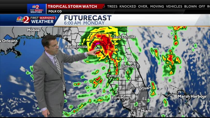
Before reaching landfall in Florida’s Big Bend on Monday, the storm was probably going to strengthen into a powerful Category 1 hurricane, according to the National Hurricane Center in Miami.
From there, Debby was predicted to travel eastward over northern Florida before coming to a stop over Georgia and South Carolina’s coastal regions. Starting on Tuesday, the area could experience record-breaking rains totaling up to 30 inches (76 centimeters).
“There’s some really amazing rainfall totals being forecast and amazing in a bad way,” Michael Brennan, director of the hurricane center, said at a briefing. “That would be record-breaking rainfall associated with a tropical cyclone for both the states of Georgia and South Carolina if we got up to the 30 inch level.”
Flooding impacts could last through Friday and are expected to be especially severe in low-lying areas near the coast, including Savannah, Georgia; Hilton Head, South Carolina; and Charleston, South Carolina.
Officials in Savannah said the area could see a month’s worth of rain in four days if the system stalls over the region.
“This is going to a significant storm. The word historic cannot be underscored here,” Savannah Mayor Van. R. Johnson said during a press conference.
The hurricane center said in a 2 p.m. update that Debby was located about 125 miles (205 kilometers) west-southwest of Tampa, Florida, with maximum sustained winds of 65 mph (105 kph). The storm was moving north-northwest at 13 mph (21 kph).

Be the first to comment