FIRST ALERT: With Debby now a hurricane, sections of South Carolina may experience “catastrophic flooding.
Debby makes landfall as a category 1 hurricane near Steinhatchee Florida just north of Horseshoe beach.
Air Force Reserve Hurricane Hunter aircraft observations and Doppler radar images from Tallahassee indicate that the center of Hurricane Debby has made landfall around 7am.
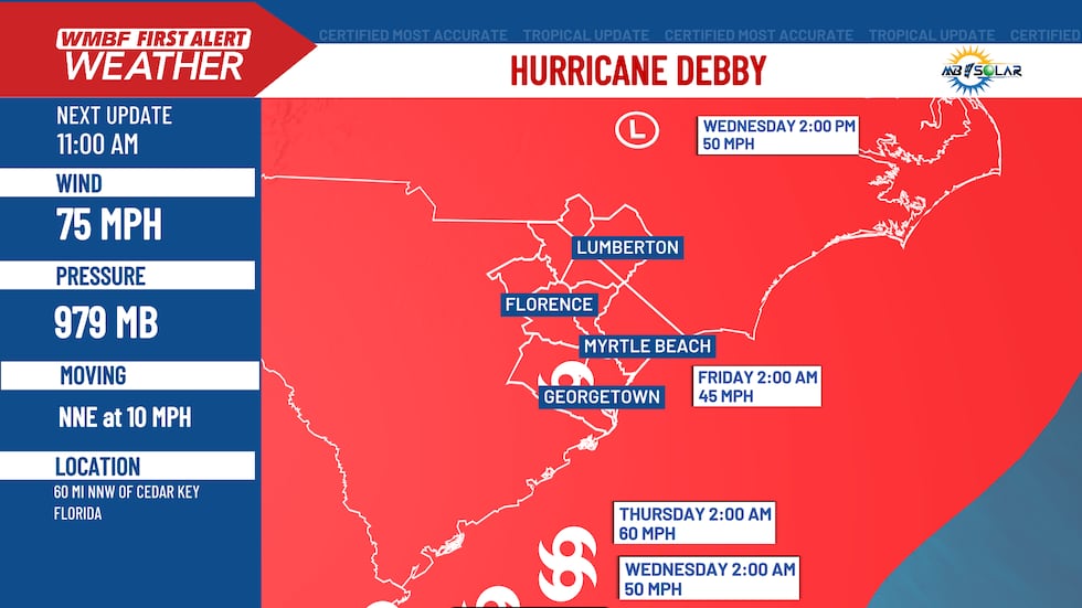
Debby’s intensity will drop when it passes over Florida.(WMBF News) The center is expected to move slowly across southern Georgia and northern Florida on Tuesday and Wednesday, and by Tuesday night, it should be close to the Georgia coast. Maximum sustained winds have reduced to approximately 75 mph with stronger gusts.
Debby is expected to weaken further as she moves over land today and tonight. Up to 25 miles out from the center, hurricane-force winds and tropical storm-force winds can be felt, respectively, for up to 140 miles. A wind gust to 62 mph was reported at Madison County High School within the last hour. The projected lowest central pressure is 979 MB.
Even with the forecast track showing Debby rolling through South Carolina on Thursday, we will see impacts from Debby as early as Tuesday as tropical downpours become more likely. Right now, the forecast track calls for Debby to be a tropical storm moving through the Carolinas Thursday and into early Friday morning.

Be the first to comment