The National Oceanic and Atmospheric Administration (NOAA) has recently made a significant announcement about the growing importance of satellite monitoring for severe weather outbreaks. The agency’s National Environmental Satellite, Data, and Information Service (NESDIS) has predicted that severe weather patterns, including thunderstorms, tornadoes, and hurricanes, are likely to intensify in the coming years. As climate change continues to play a role in the unpredictability and intensity of weather events, satellite technology becomes increasingly critical for accurately tracking these outbreaks.
NOAA’s NESDIS operates a network of advanced weather satellites that provide real-time data on environmental changes and the progression of severe weather systems. These satellites have been key in predicting and monitoring storms, providing the necessary data for meteorologists and emergency response teams to make informed decisions and issue timely warnings. In recent years, technological advancements have allowed NOAA satellites to improve the precision of weather forecasts, especially when it comes to detecting and tracking extreme weather.
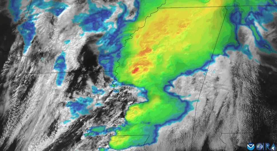
The satellite data collected by NESDIS provides essential insights into several aspects of severe weather. For instance, satellites can monitor atmospheric conditions, sea surface temperatures, and cloud cover, which are critical in determining the potential for severe weather events like hurricanes and tornadoes. Additionally, satellites help track the intensity and movement of these storms, which is crucial for issuing accurate and timely warnings to affected communities. With the ability to track storm paths and monitor changes in real-time, NESDIS can better predict the impact of severe weather events and advise the public on how to prepare.
One of the most remarkable developments in satellite technology is the enhancement of geostationary satellites. These satellites orbit the Earth at a fixed position, allowing them to monitor a specific area continuously. This ability is essential for tracking severe weather outbreaks as they unfold in real-time, providing meteorologists with an uninterrupted flow of data. The geostationary satellites that NOAA operates are equipped with advanced imaging systems that allow them to capture high-resolution images and videos of weather phenomena, providing a more comprehensive picture of storm development and movement.
In addition to geostationary satellites, NOAA also utilizes polar-orbiting satellites, which fly in a different orbit that allows them to observe the Earth from a variety of angles. This capability provides a more global perspective on weather patterns and is particularly useful for monitoring events like wildfires, floods, and blizzards, which can occur in remote or isolated regions. With both types of satellites working in tandem, NESDIS is able to offer a more complete and accurate understanding of the current state of the atmosphere.
NOAA’s partnership with other global weather organizations further strengthens the accuracy and timeliness of weather predictions. By sharing satellite data with agencies around the world, NOAA helps enhance global weather forecasting and disaster preparedness. The collaboration ensures that countries can respond to severe weather outbreaks more effectively, potentially saving lives and minimizing damage.
As climate change accelerates, severe weather events are expected to become more frequent and intense. Therefore, monitoring systems like those operated by NOAA’s NESDIS will play an even more critical role in public safety. By improving satellite technology and expanding data collection capabilities, NOAA can continue to provide early warnings and support for communities in the path of severe weather. These advancements in satellite technology will be key in mitigating the impacts of natural disasters, ultimately saving lives and reducing economic losses.

Be the first to comment